Lot 165
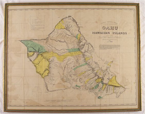
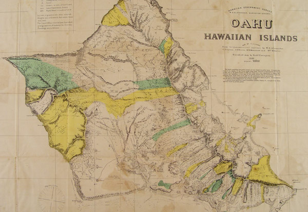
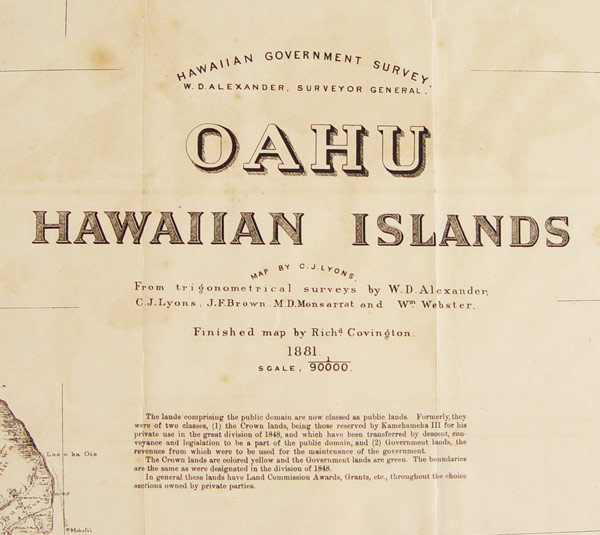
1881 W. D. ALEXANDER OAHU HAWAII MAP: Hawaiian Government Survey by W. D. Alexander, Surveyor General. Map by C. JH. Lyons. This map represents a survey of public and private lands, 18 years before annexation into the US. Signe size 28'' x 35 1/2'', framed 29 1/2'' x 37''.
CONDITION: Note foxing, not examined out of frame.