Lot 1205
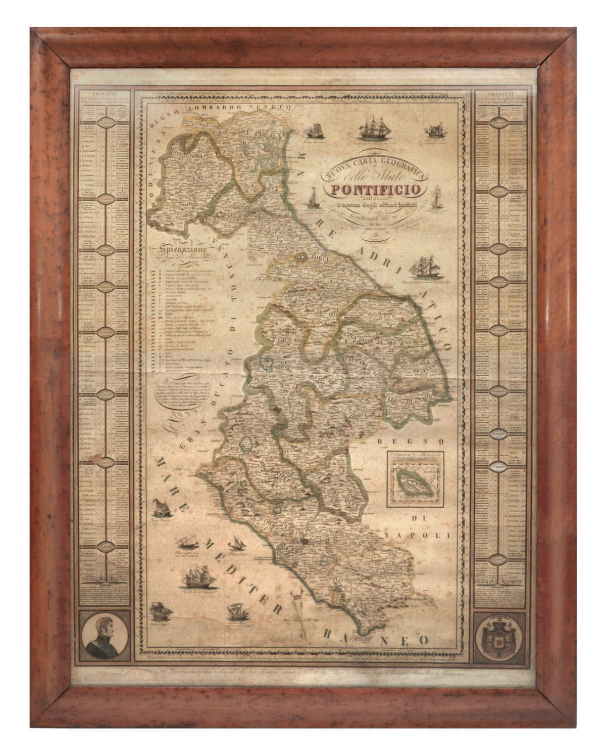
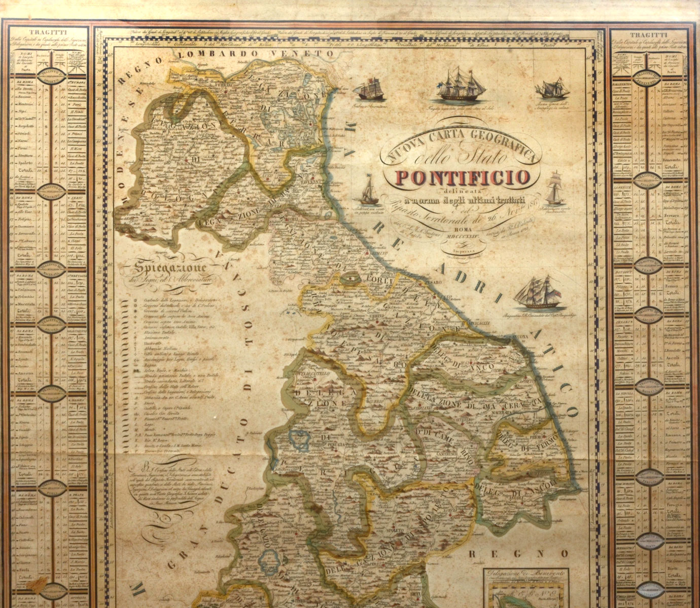
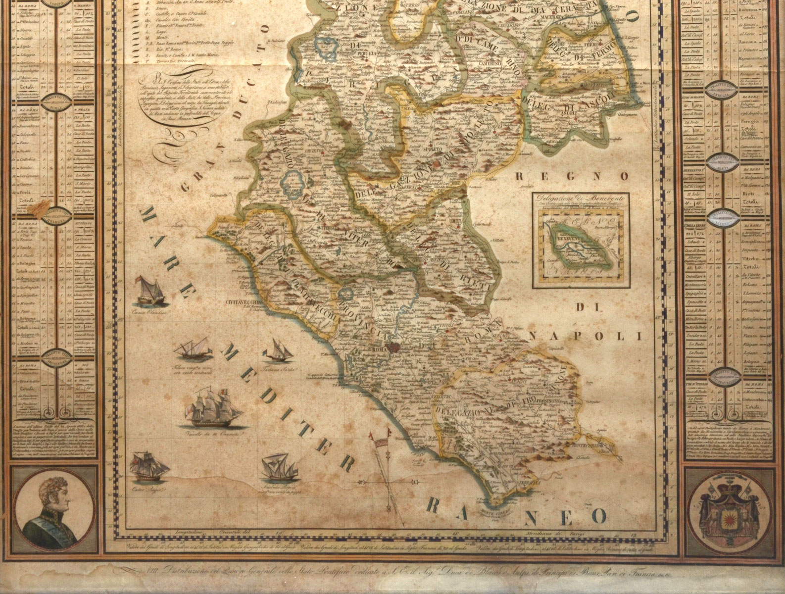
NUOVA CARTA GEOGRAFICA, DELLO STATO, PONTIFICIO MAP: Old Italian map of the papal state-1824. Copper engraving highlighted with watercolor. Having all the provinces and legations of the papal state after the Congress of Vienna of 1815, engraved by Francesco Valenti and printed by Ludovico Riccardi. Outlined under the last treaties. Territorial allotting of 26 November 1917. Framed in Bird's Eye Maple Approx. 37.25'' h x 29.25'' w.
CONDITION: Age consistent foxing to paper, A couple spots of veneer loss to frame.