Lot 1351
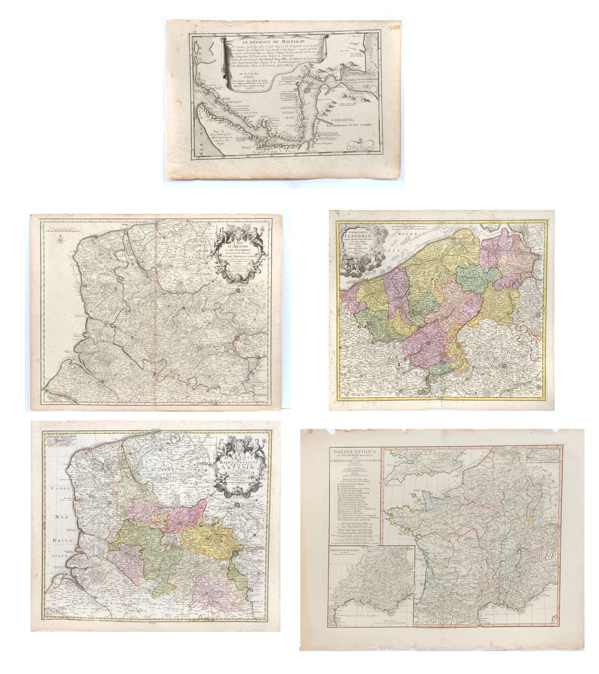
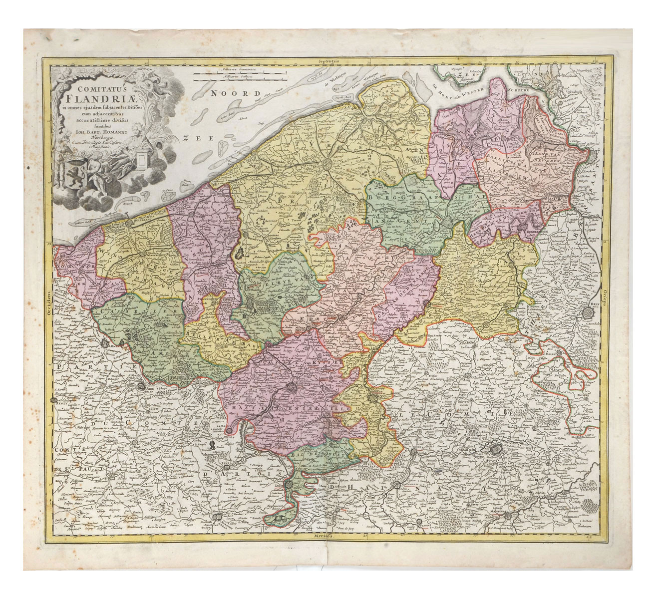
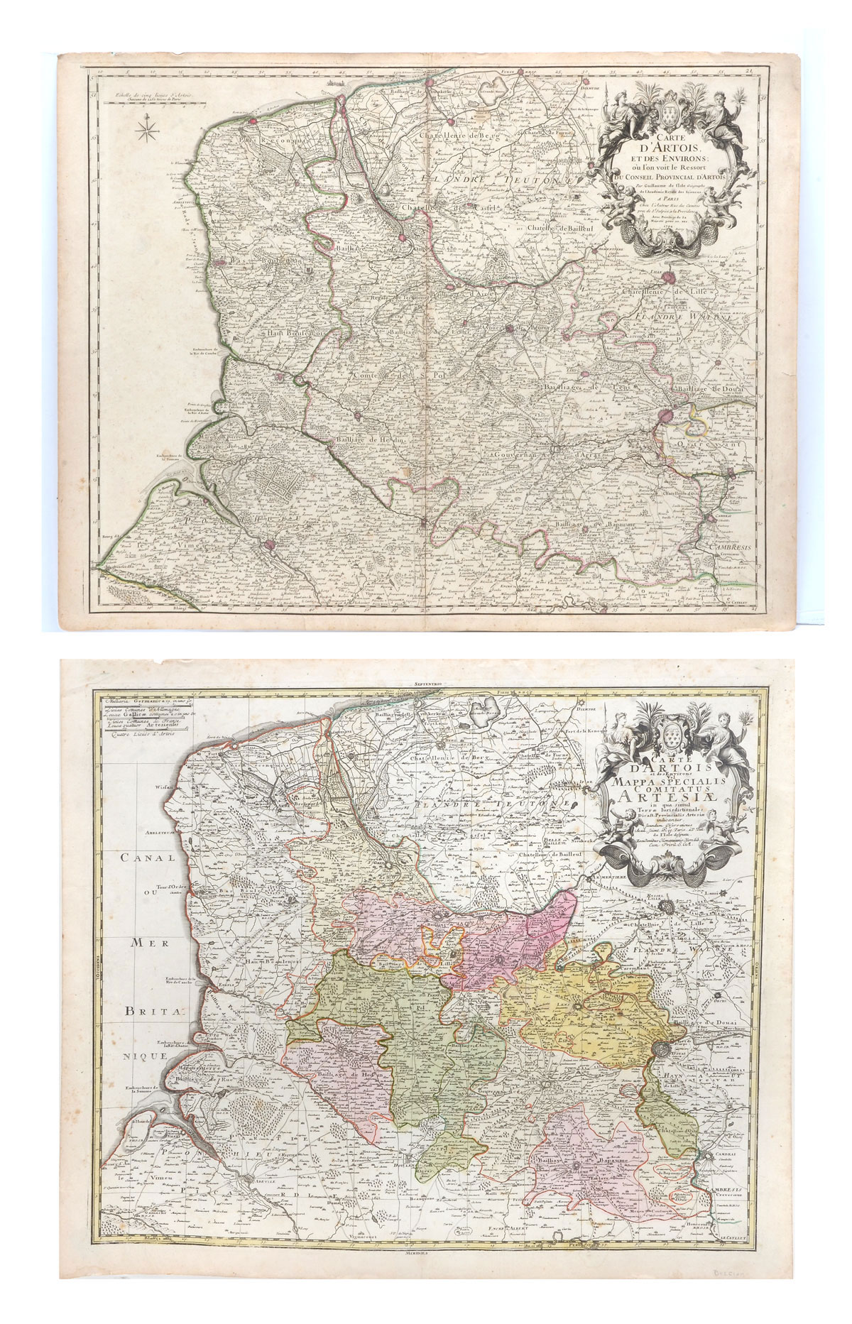
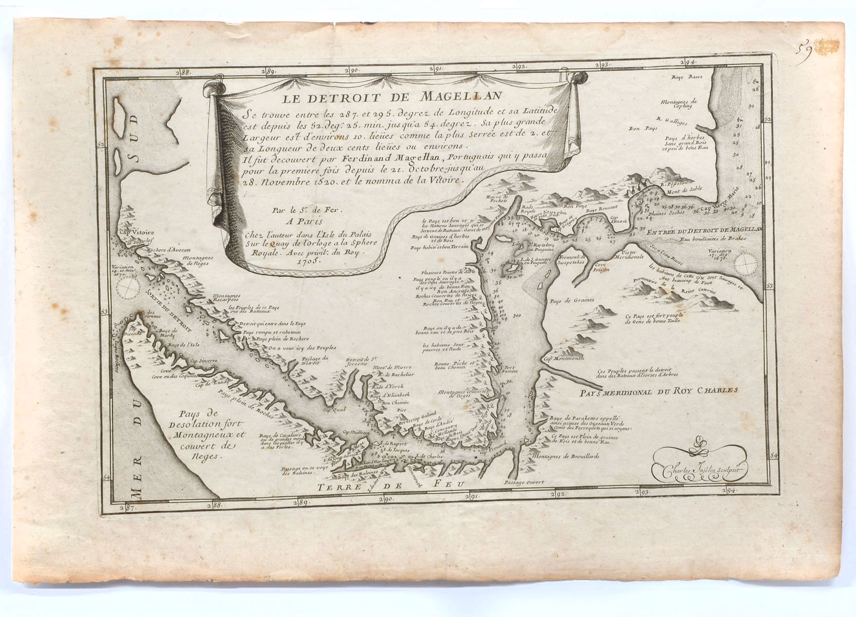
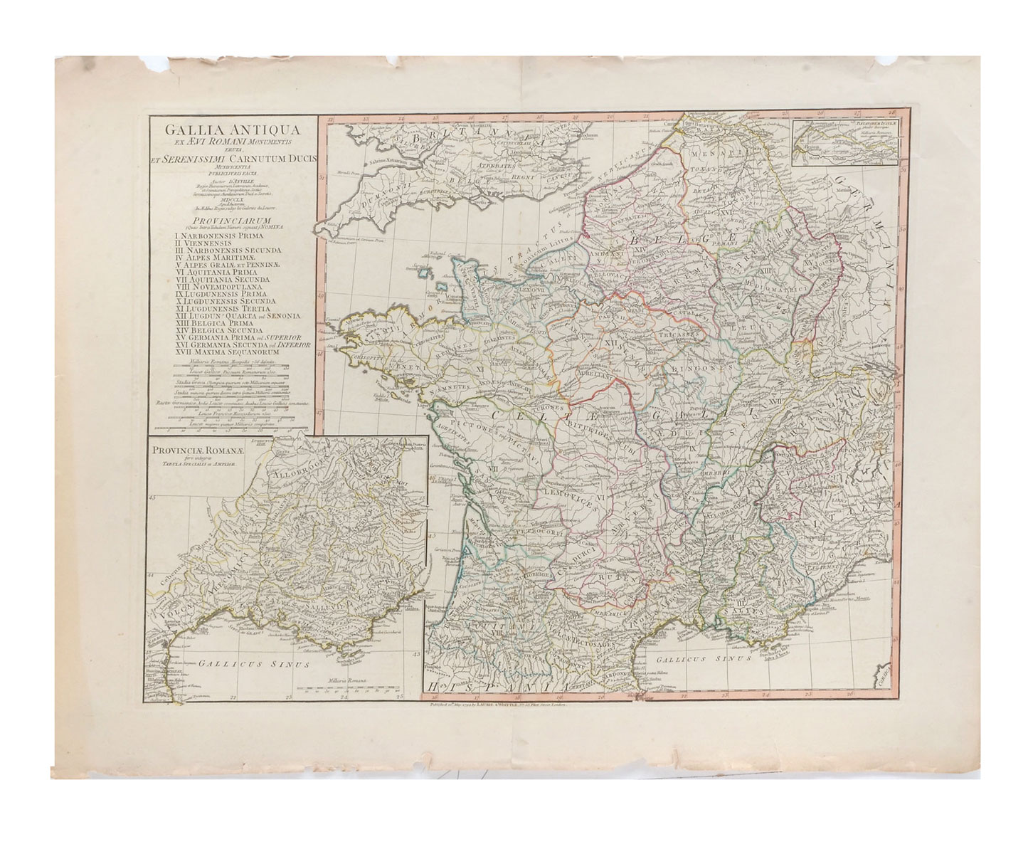
4 LOTS OF ANTIQUE MAPS: 1) Nicholas de Fer (1646-1720), ''Le Detroit de Magellan,'' 1705, Map of the Straits of Magellan. Approx. 11'' h x 16.25'' w. 2) 2 OLD CARTE D'ARTOIS MAPS: Pair of copper engraved atlas maps of the Artois France from Dunkirk Belgium to Abbeville France in the west, to Lille, Doue and Cambrai in the East. Made by Homann, Johann Baptist; Erben von. Nuremberg Germany. One map is dated 1704. 1- Approx. 21'' h x 24.25'' w. 1- Approx. 20.25'' h x 26.25'' w. 3) 1760 D'ANVILLE MAP OF FRANCE DURING ROMAN TIMES: map of Roman period France. Some topographical and settlement details. The 17 Roman provinces within France are listed. Inset is a more detailed map of France. Latin text. Published in London by Robert Sayer. Approx. 21.5'' h X 27.75'' w. 4) JOHANN BAPTIST HOMANN BELGIUM MAP: Flanders Old antique map of the coastline of Belgium with fortified towns and decorative title cartouche. By Johann Baptist Homann. Approx., 21'' h x 24'' w.
CONDITION: Foxing, Minimal loss at edges, crease in center and left side.