Lot 1352
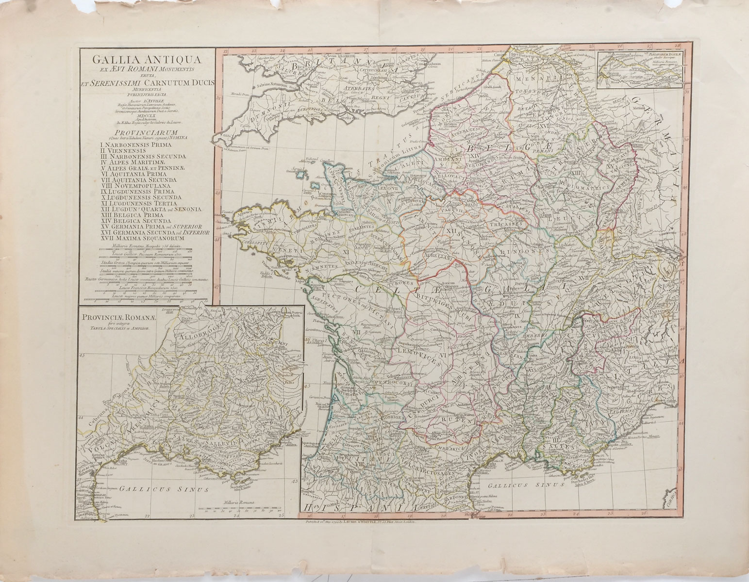
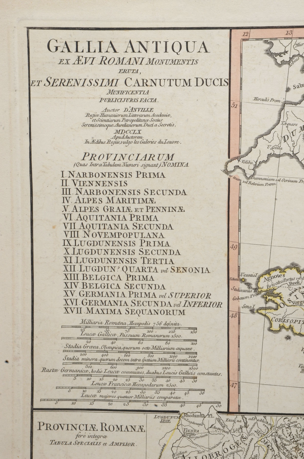
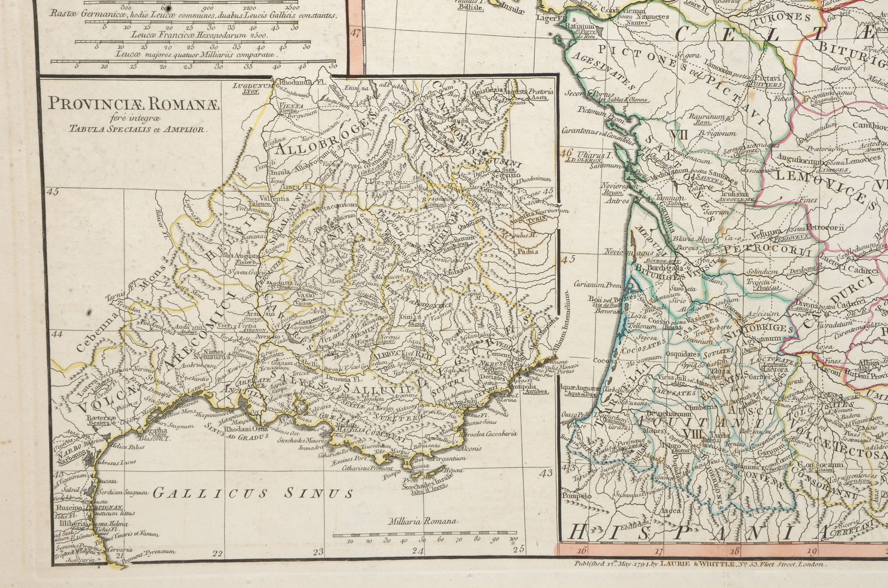
1760 D'ANVILLE MAP OF FRANCE DURING ROMAN TIMES: map of Roman period France. Some topographical and settlement details. The 17 Roman provinces within France are listed. Inset is a more detailed map of France. Latin text. Published in London by Robert Sayer. Approx. 21.5'' h X 27.75'' w.
CONDITION: Foxing, loss at edges, crease & seamed in center. Tears in margin.