Lot 340
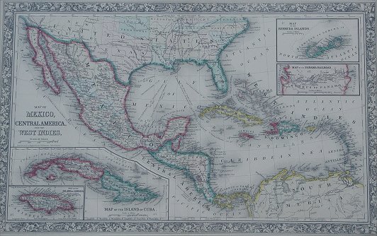
MAP OF MEXICO, CENTRAL AMERICA AND THE WEST INDIES: Constructed and engraved by W. Williams of Philadelphia, dated 1860, hand colored, sight size 13 1/4 '' x 21 1/4''. Quite possibly a 20th century reprint, but there is a probability that this is a period map dating to 1860.