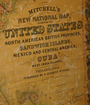
Lot 1300
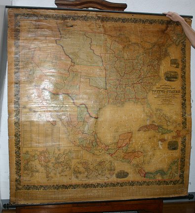
MITCHELL'S 1856 NORTH AMERICAN WALL MAP: First Edition 1856 of the United States, Mexico and West Indies, with inset maps Hawaii (the Sandwich Islands). Map includes the 1854 Gadsen purchase, the 1855 US / Mexico border, and outlines 3 proposed transcontinental railroad routes, North, South, and Central. Constructed and engraved by W. Williams, published by Mitchell. 60'' x 60''. Please call for condition.