Lot 1071
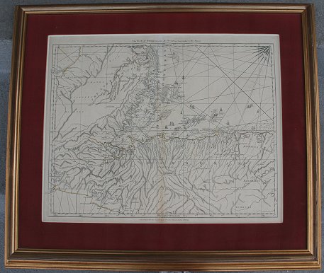
1775 JEFFREYS' BRITISH MAP BAY OF HONDURAS: Charted by Thomas Jefferys, Geographer to his Majesty. Published by Sayer, London 1775. Nautical chart covering parts of Honduras, Belize, Guatemala, El Salvador, Nicaragua and islands of the West Indies. Note some foxing along fold lines. Sight size 19 3/4'' x 25 3/4'', framed and matted 28 1/2'' x 34 3/4''.