Lot 148
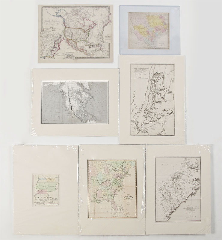
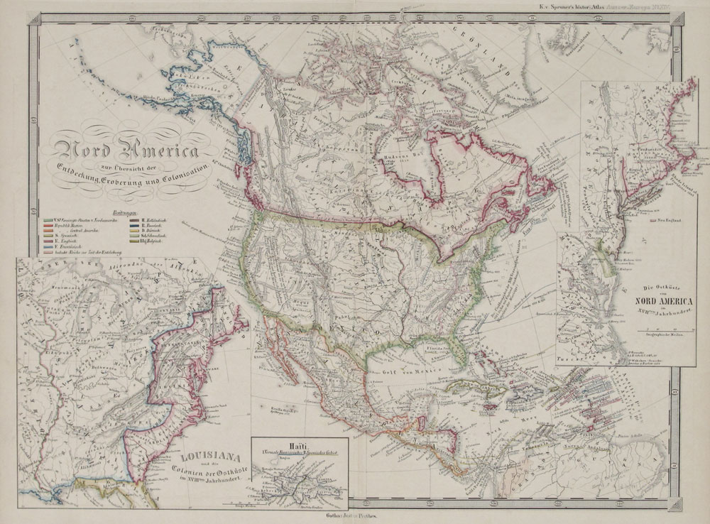
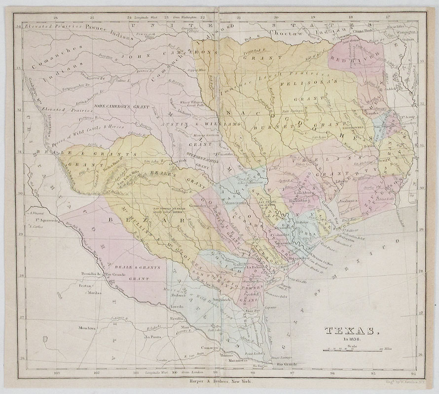
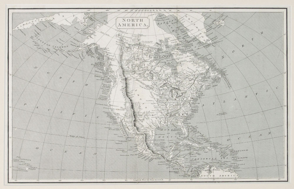
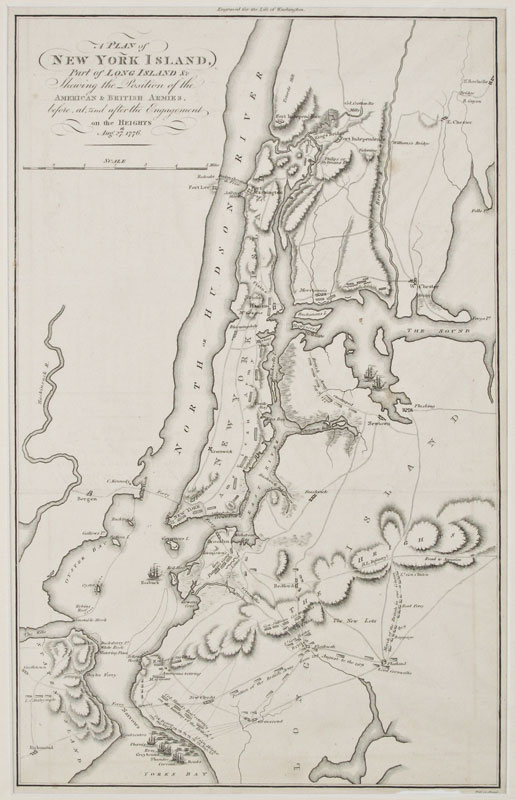
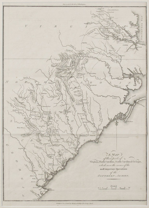
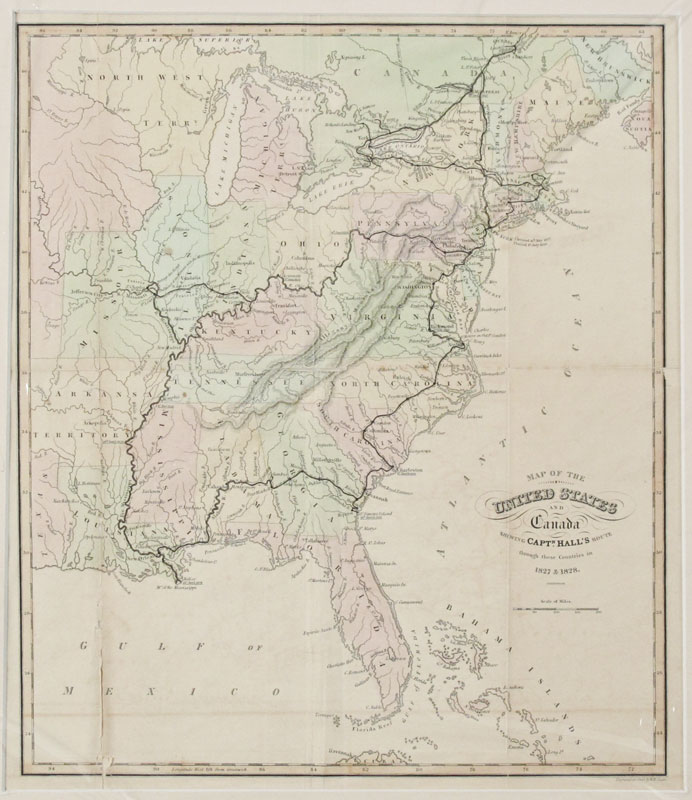
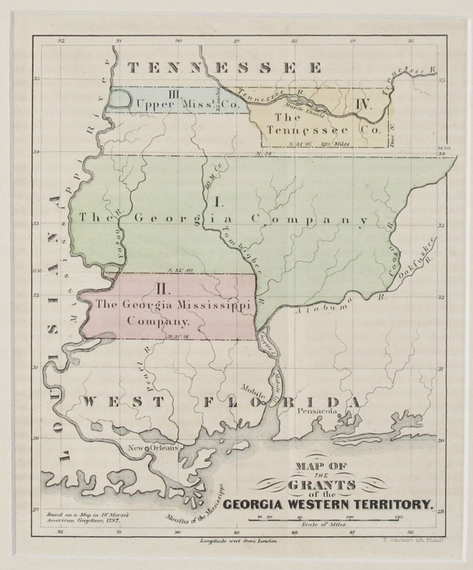
COLLECTION OF 7 ANTIQUE US MAPS: To include 1) 1806 ''A map of Virginia, North Carolina, South Carolina and Georgia''. Engraved by Samuel Neele, published by Richard Phillips. Sight size 15'' x 10 1/2''. 2) 1806 ''A Plan of New York, part of Long Island, & Showing the Position of the American & British Armies'' by Richard Phillips. Sight size 16 1/4'' x 10 1/4''. 3) 1800 ''Maps of the Grants of the Georgia Western Territory'' by T. Sinclair. Sight size 7 1/2'' x 6 1/4''. 4) 1829 ''Map of the United States and Canada showing Capt. Hall's route through the countries in 1827 & 1828'', engraved by W. H. Lizars. Sight size 13 1/4'' x 11 3/4''. 5) 1836 ''Texas in 1836'' by Harper & Brothers, New York. 8 1/2'' x 9 3/4''. 6) 1840's ''Nord America'' with insets of Louisiana, Haiti and New England by Justus Perthes. 13 1/4'' x 17 1/2''. 7) ''North America'' unknown maker, dates early to mid 19th century. Sight size 9 3/4'' x 15 1/2''.
CONDITION: 5 are matted, not examined out of mat. Note typical page fold lines, wear on edges, toning.