Lot 1263
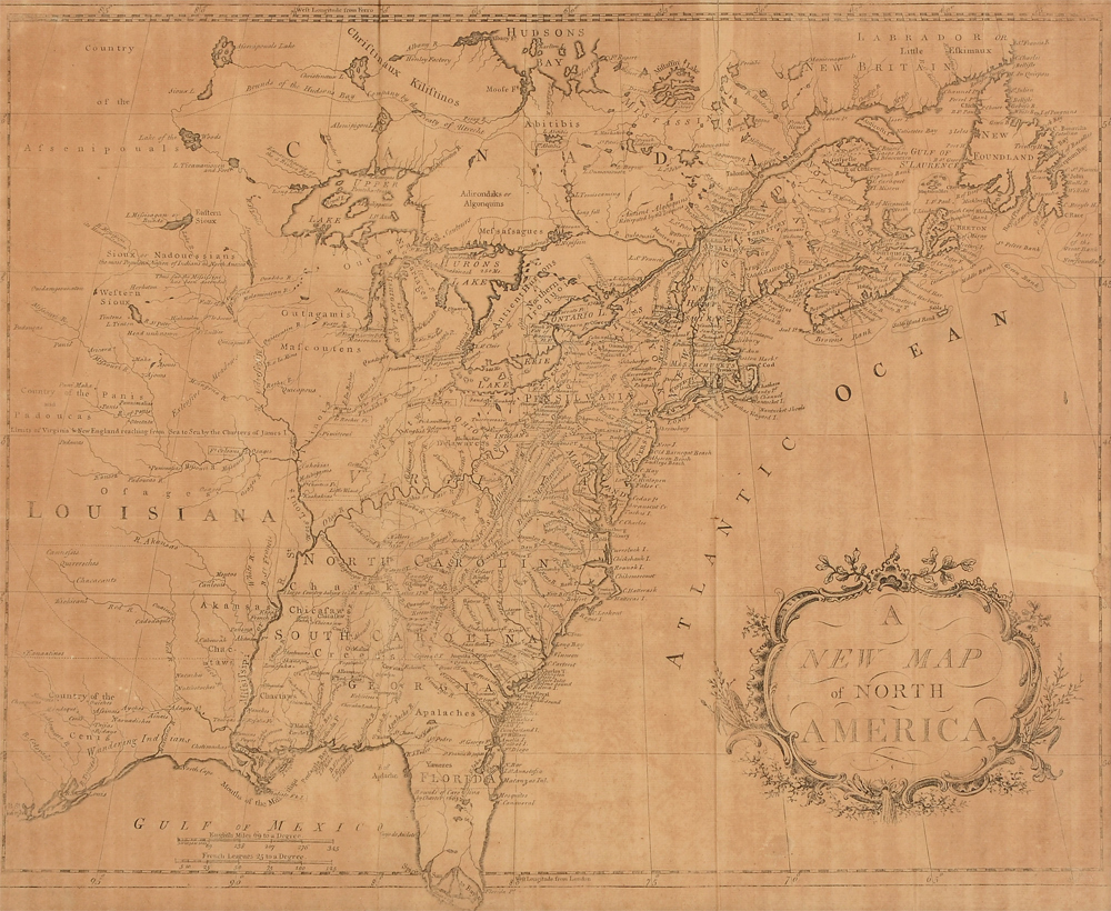
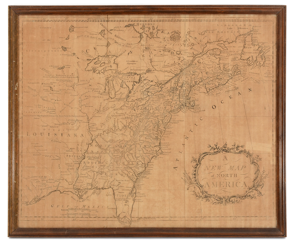
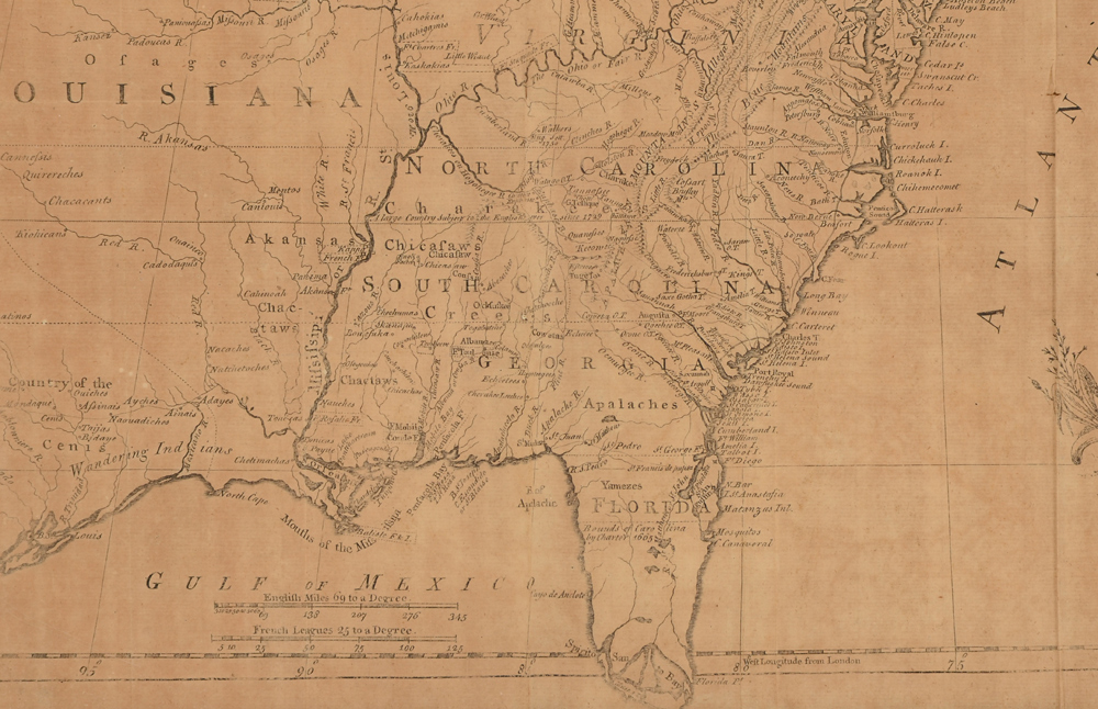
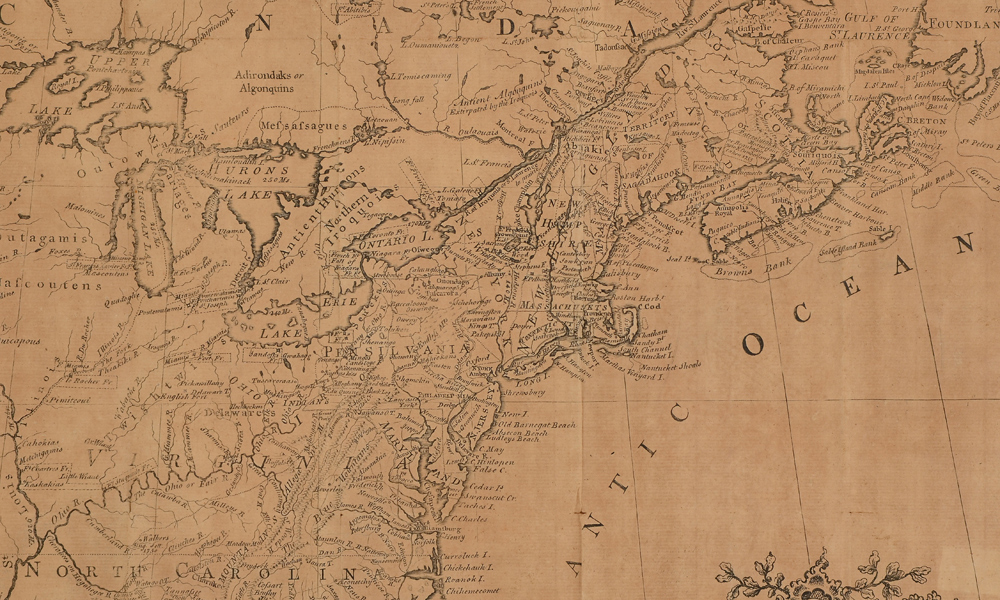
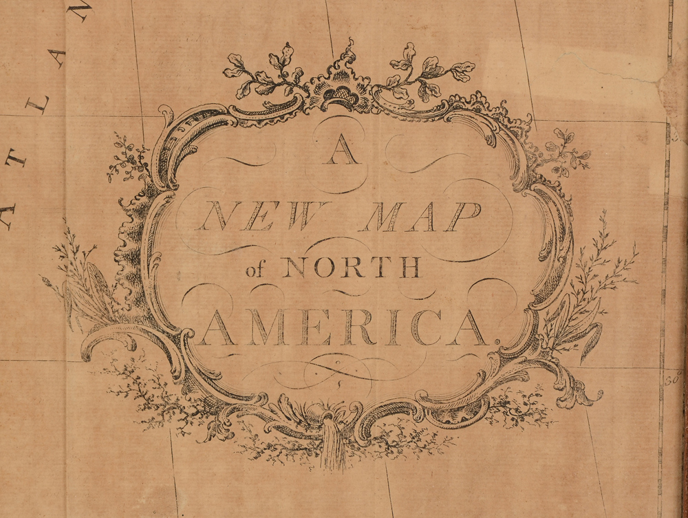
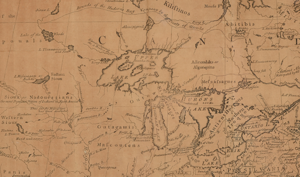
18TH CENTURY MAP OF NORTH AMERICA: Titled ''A New Map of North America'', no visible printer or cartographer name. Map shows the entire east coast, extending into Louisiana to the west, Newfoundland to the north, Florida to the south. Also lists Native American tribe locations. Sight size 17 1/2'' h. x 21 1/4'', framed 19'' x 23''.
CONDITION: Visible fold lines, edge tears, not examined out of frame.